
Porcupine Ridge
- Aug 26, 2025
- 3 min read

* Dayhike, in and out. No sign or toilet at trailhead. Dogs must be leashed.
* Distance: 10 kms return (roughly 4-5 hrs)
* Elevation gain: Roughly 730 m
* Difficulty: Intermediate/difficult
* Trailhead: Unofficial parking lot on Hwy 40 at Porcupine Creek (16.5 kms from Hwy 1). You can also park at Wasootch Day Use and hike through the forest to meet up with the trail at Porcupine Creek, but this will add about 2 kms to your day.
Trail description
Walk down the well-defined path, on the left along the wide creek, for about 1 km until you hit the bridge. You can cross the bridge if you’d like; this is the connector trail that runs through the forest to Wasootch (about 2 kms away). Either way, you'll eventually have to cross the stream a few times further down, so choose the side of your liking.
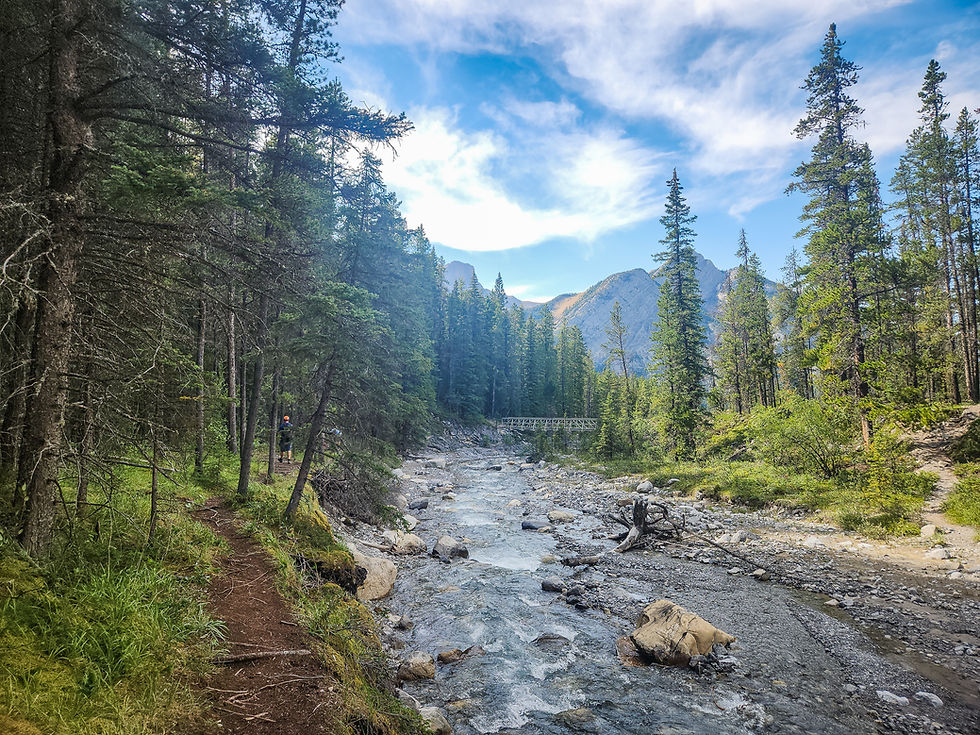
Not long after the bridge, you’ll notice the trail will disappear. This means you'll have to meander your way across the stream; there are usually lots of rocks and logs to step onto (hiking poles help here).

If water levels are high or if it’s rained over the last few days, you might consider bringing a pair of water shoes or even an extra pair of socks in case you get a soaker.

At the end of the rocky stream, you’ll spot a few blue ribbons in the trees. The first ‘hump’ of Porcupine Ridge looks almost like a rock wall, with a faint dirt trail leading right up. This is the way. Time to roll up your sleeves, and make sure you have plenty of water.


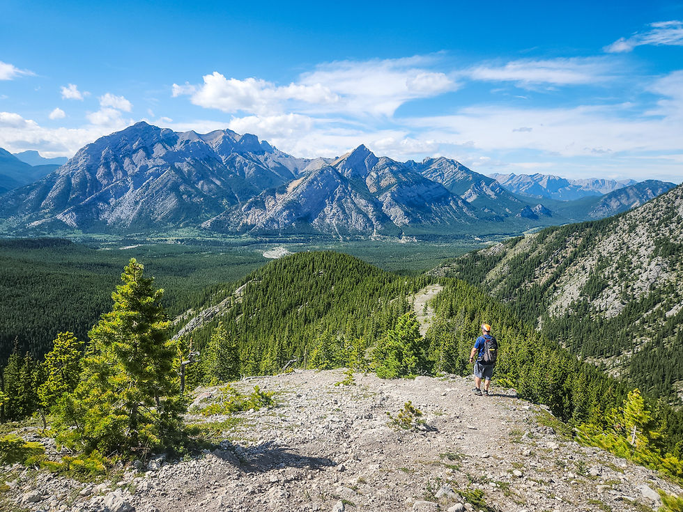
After about 30-40 minutes of pushing upwards and gaining almost 300m of elevation, you’ll emerge from the trees onto the open, rocky ridge. The good views will keep coming from here on.

The trail stays relatively open from this point and the elevation does level out, even though it’s another (more gradual) 400m to the true summit.
Keep walking along the ridge to reach the end of the first, never-ending hump. You’ll spot the second hump looming in front of you. It looks much more daunting than it actually is.

Many people stop here, have a bite to eat and turn around, as the views are pretty stunning. I urge you to push on.
Jason and I were on a time-crunch on this day, so he pushed on ahead of me to get as high as possible. The photo below is as far as he got.

The trail apparently gets a bit more technical and scrambly as you approach the ‘true summit’. I had no problem ending our day here.

The beauty of these types of hikes is that you can turn around anytime after you’ve reached the open ridge and still feel like you got your money’s worth of panoramic landscapes. Whenever you get tired, just retrace your steps.
You’ll want hiking poles for the steep descent and for the creek crossings, especially if the water is high. In shoulder seasons, bring small crampons in your bag for the steep descent.
See you on the trails!


Comments